What is Geography: A Comprehensive Exploration
February 5, 2024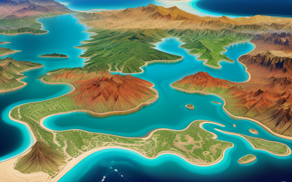
Geography is the study of the Earth’s physical features, human populations, and the ways in which they interact. It encompasses a wide range of topics, including climate, vegetation, soils, rivers, mountains, and the oceans. Geography is also concerned with the human activities that shape the Earth’s surface, such as agriculture, mining, urbanization, and transportation. In short, geography is the study of the Earth and the people who live on it.
Body:
The word “geography” comes from the Greek words “ge” meaning “earth” and “grapho” meaning “to write or describe.” This field of study has been around for centuries, with ancient civilizations like the Greeks and Romans making important contributions to our understanding of the world. Today, geography is a highly interdisciplinary field that draws on a wide range of other disciplines, including biology, economics, history, and political science.
One of the key goals of geography is to help us understand the complex relationships between humans and the environment. This includes examining how natural processes like climate change and land use patterns impact human societies, as well as how human activities in turn affect the environment. Geographers also study the distribution of human populations, cultures, and languages, and how these factors shape the world around us.
Overall, geography is a fascinating and dynamic field that offers insights into some of the most pressing issues facing our world today, from climate change to urbanization to globalization. By studying geography, we can gain a deeper understanding of the world around us and the ways in which we interact with it.
Definition of Geography
Branches of Geography
Physical Geography
Physical geography is the branch of geography that studies the natural environment and its processes. It encompasses a wide range of topics, including climate, landforms, and water systems.
Climate
Climate is a fundamental aspect of physical geography. It refers to the long-term patterns of temperature and precipitation in a particular region. Climate is influenced by a variety of factors, including latitude, altitude, proximity to bodies of water, and the presence of mountains or forests. Studying climate helps scientists understand how it affects ecosystems, human activities, and the distribution of plants and animals.
Landforms
Landforms are the physical features of the Earth’s surface, including mountains, valleys, deserts, and coastlines. Landforms are shaped by geological processes such as erosion, deposition, and tectonic activity. They also play a crucial role in the formation of climate, as they influence the movement of air masses and the distribution of precipitation.
Water Systems
Water systems are another important aspect of physical geography. They include rivers, lakes, oceans, and groundwater. Studying water systems helps scientists understand how they are interconnected and how they influence the environment and human activities. For example, understanding the water cycle is crucial for predicting floods, droughts, and other extreme weather events.
Human Geography
Human geography is the branch of geography that studies the relationships between humans and their environment. It encompasses a wide range of topics, including population, culture, and economic activities.
Population
Population is a key aspect of human geography. It refers to the number of people living in a particular region. Studying population helps scientists understand how it affects the environment, economy, and society. For example, population density can impact the availability of resources such as food, water, and housing.
Culture
Culture is another important aspect of human geography. It refers to the shared beliefs, values, customs, and behaviors of a particular group of people. Studying culture helps scientists understand how it affects social and economic systems, as well as how it shapes the environment. For example, cultural practices such as farming, fishing, or hunting can impact the use of natural resources.
Economic Activities
Economic activities are a critical component of human geography. They include activities such as agriculture, industry, and services. Studying economic activities helps scientists understand how they are interconnected and how they impact the environment and society. For example, understanding the global economy is crucial for predicting trade patterns and economic growth.
Key Concepts in Geography
Spatial Analysis
Remote Sensing
Remote sensing is a technique used in geography to gather data about the Earth’s surface without any direct contact. This method uses sensors and instruments mounted on aircraft or satellites to capture images of the Earth’s surface. These images can be used to create maps, monitor changes in land use, and study the Earth’s surface features.
Geographic Information Systems (GIS)
Geographic Information Systems (GIS) is a computer-based tool used to store, manipulate, and analyze geographic data. GIS allows users to create maps, analyze spatial relationships, and model spatial processes. GIS is used in a wide range of fields, including urban planning, environmental management, and natural resource management.
Spatial analysis is a method used in geography to analyze the spatial relationships between different phenomena. This method involves the use of statistical and mathematical techniques to understand how different variables are related to each other in space. Spatial analysis is used to study a wide range of phenomena, including population distribution, land use patterns, and the distribution of natural resources.
One of the key tools used in spatial analysis is geostatistics, which is a method used to analyze spatially referenced data. Geostatistics allows researchers to identify patterns and trends in data that would be difficult to detect using traditional statistical methods.
Another important tool used in spatial analysis is spatial interpolation, which is a method used to estimate values at unmeasured locations based on data from measured locations. Spatial interpolation is used to create maps and models that can be used to predict future trends and patterns.
Overall, spatial analysis is a powerful tool used in geography to understand the complex relationships between different phenomena in space. By using advanced statistical and mathematical techniques, researchers can gain valuable insights into the spatial patterns and trends that shape our world.
Regional Geography
Patterns and Processes
Regional geography is a branch of geography that focuses on the study of regions, their characteristics, and the processes that shape them. This field of study examines the physical, cultural, and social aspects of regions, and how they interact with one another.
One of the key concepts in regional geography is patterns and processes. This refers to the study of the spatial patterns and the underlying processes that create these patterns. Spatial patterns can include things like the distribution of resources, population density, and land use patterns. The underlying processes that create these patterns can include factors such as climate, tectonic forces, and human activity.
Sense of Place
Another important concept in regional geography is the sense of place. This refers to the unique characteristics that give a region its distinct identity. Factors that contribute to a sense of place can include natural features such as landforms and climate, as well as cultural factors such as history, language, and customs.
Understanding the sense of place is important for a number of reasons. It can help us to understand the unique challenges and opportunities that a region faces, as well as the ways in which people interact with and shape their environment. Additionally, understanding the sense of place can help us to appreciate the diversity of human experience and the ways in which different regions are shaped by their cultural, social, and environmental contexts.
Importance of Geography
Understanding the World
Global Interconnections
Geography plays a crucial role in understanding the world by examining the relationships between people, places, and environments. Through the study of global interconnections, geographers investigate how human activities and natural processes shape and are shaped by the world around us.
- Trade: The movement of goods and services across borders has significant impacts on economies, societies, and environments. By studying the patterns of trade, geographers can better understand the interconnections between countries and regions.
- Migration: Human migration is another key aspect of global interconnections. Factors such as economic opportunities, political instability, and environmental change can lead individuals and groups to move from one place to another. Understanding the causes and consequences of migration helps geographers analyze the complex relationships between people and places.
- Climate Change: The global climate is constantly changing, and these changes have far-reaching impacts on both human societies and the natural environment. Geographers study the patterns and causes of climate change, as well as its effects on various regions and ecosystems.
Natural Resource Management
Natural resources, such as water, soil, and minerals, are essential for the survival and development of human societies. Effective management of these resources is critical for maintaining ecological balance and ensuring long-term sustainability. Geography plays a crucial role in natural resource management by providing insights into the spatial distribution and dynamics of these resources.
- Water Resources: Access to clean water is a major concern for many parts of the world. Geographers study the distribution and availability of water resources, as well as the factors that influence their quality and quantity. This information is crucial for developing effective water management strategies and ensuring that water is used sustainably.
- Soil Erosion and Degradation: Soil erosion and degradation are significant environmental issues that can have serious consequences for agricultural productivity and ecosystem health. By examining the processes that lead to soil degradation and erosion, geographers can help develop sustainable land use practices that minimize these impacts.
- Mineral Resources: Minerals are essential for many modern technologies and industries, but their extraction and use can have significant environmental and social impacts. Geographers investigate the spatial distribution of mineral resources, as well as the social and environmental consequences of their extraction and use. This information is crucial for developing sustainable mining practices and ensuring that mineral resources are used in a responsible and equitable manner.
Career Opportunities
Private Sector
Geography is an interdisciplinary field that combines physical and human sciences to study the Earth’s features, processes, and human activities. In the private sector, geography graduates can find employment in various industries such as:
- Cartography and GIS
- Surveying and Mapping
- Environmental Consulting
- Urban Planning and Development
- Transportation and Logistics
- Natural Resources Management
- Real Estate and Property Development
Public Sector
In the public sector, geography graduates can work for government agencies such as:
- National Park Service
- United States Geological Survey (USGS)
- National Oceanic and Atmospheric Administration (NOAA)
- Federal Emergency Management Agency (FEMA)
- Department of Transportation
- Environmental Protection Agency (EPA)
Academic Sector
Geography graduates can also pursue careers in academia by becoming professors, researchers, or lecturers at universities, colleges, and community colleges. They can also work as instructors in secondary schools, museums, and non-profit organizations. Additionally, geography graduates can pursue graduate studies in geography or related fields such as urban planning, environmental science, and geographic information science.
Challenges in Geography
Data Collection
Primary Data
Surveys
- Quantitative research methods
- Self-administered questionnaires
- Face-to-face interviews
- Telephone interviews
- Online surveys
Field Observations
- Systematic and non-systematic observations
- Use of transects, quadrats, and pacing methods
- Duration and frequency of observations
- Recording and analyzing data
Secondary Data
Sources of Secondary Data
- National and international statistical agencies
- Research institutions and think tanks
- Non-governmental organizations (NGOs)
- Academic and research libraries
- Internet sources
Advantages and Limitations of Secondary Data
- Advantages:
- Cost-effective and time-saving
- Large amounts of data available
- Provides a broader perspective
- Limitations:
- May not be specific to the research question
- Outdated or incomplete data
- Biased or subjective interpretations
Integrating Technology
In today’s world, technology has become an integral part of almost every field, including geography. While technology has revolutionized the way geographers collect, analyze, and interpret data, it also presents a number of challenges. In this section, we will explore some of the limitations of technology in geography and how geographers can embrace technological advancements to overcome these challenges.
Limitations of Technology
One of the biggest limitations of technology in geography is the potential for bias. For example, geospatial technologies like satellite imagery and LiDAR can only capture data within their range of detection, which can result in incomplete or inaccurate representations of the Earth’s surface. Additionally, the use of digital maps and geographic information systems (GIS) can reinforce existing power structures and perpetuate social inequalities.
Another limitation of technology in geography is the cost of acquiring and maintaining technological tools. Many geographers, particularly those in developing countries, may not have access to the latest technologies or may not be able to afford them. This can result in a digital divide, where some geographers have access to advanced technologies while others do not.
Embracing Technological Advancements
Despite these limitations, geographers can still embrace technological advancements to improve their research and better understand the world around them. One way to overcome the limitations of technology is to use multiple sources of data, including both traditional and digital sources. By integrating traditional methods like field surveys with digital tools like GIS and remote sensing, geographers can get a more complete picture of the Earth’s surface.
Another way to overcome the limitations of technology is to engage in critical analysis of the data. Geographers should be aware of the potential biases and limitations of the technologies they use and critically evaluate the data they collect. This can help to ensure that the data is accurate and representative of the real world.
In addition, geographers can work to democratize access to technology by promoting open-source software and collaborating with other researchers to develop new tools and methods. By sharing knowledge and resources, geographers can help to bridge the digital divide and ensure that everyone has access to the latest technologies.
Overall, while technology presents a number of challenges in geography, it also offers a wealth of opportunities for researchers to better understand the world around them. By embracing technological advancements and using them in a critical and responsible way, geographers can continue to push the boundaries of their field and make new discoveries about our planet.
Addressing Environmental Issues
Climate Change
Climate change is a pressing issue that geographers seek to understand and address. The earth’s climate is changing at an unprecedented rate due to human activities such as the burning of fossil fuels, deforestation, and land-use changes. These activities have resulted in an increase in greenhouse gas emissions, which trap heat in the atmosphere and lead to global warming. The consequences of climate change include rising sea levels, more frequent and severe weather events, and changes in precipitation patterns.
Geographers study the impacts of climate change on the environment, society, and economy. They use various tools and techniques such as remote sensing, GIS, and modeling to analyze data and predict future changes. They also work with policymakers and stakeholders to develop strategies for mitigating and adapting to the impacts of climate change.
Land Use and Land Cover Change
Land use and land cover change is another significant challenge faced by geographers. The way we use the land has a significant impact on the environment, economy, and society. Changes in land use can lead to habitat loss, fragmentation, and degradation, which can have negative impacts on biodiversity and ecosystem services.
Geographers study the causes and consequences of land use and land cover change. They examine the factors that drive changes in land use, such as population growth, urbanization, and economic development. They also investigate the impacts of land use changes on the environment, including soil erosion, water pollution, and loss of biodiversity.
Geographers also work with policymakers and stakeholders to develop strategies for managing land use and land cover change. This includes the development of land-use plans, zoning regulations, and environmental policies that balance economic development with environmental protection.
Recap of Key Points
Geography is a vast field that encompasses many challenges. Here is a brief recap of some of the key points that will be explored in this article:
- Defining geography: It is important to first define what geography is before delving into the challenges faced by geographers. This includes exploring the various subfields of geography and how they intersect with other disciplines.
- Data collection: Geography relies heavily on data collection, but this can be challenging due to factors such as limited resources, difficult terrain, and political tensions. Geographers must also navigate ethical considerations when collecting data in sensitive areas.
- Data analysis: Once data has been collected, geographers must analyze it to extract meaningful insights. This can be challenging due to the sheer volume of data involved, as well as the need to use advanced statistical techniques to uncover patterns and trends.
- Communicating findings: Finally, geographers must be able to communicate their findings to a wider audience. This requires not only excellent communication skills, but also the ability to translate complex data into accessible language that can be understood by policymakers, stakeholders, and the general public.
Future of Geography
Emerging Trends
The future of geography is shaped by emerging trends that challenge traditional boundaries and expand the scope of the discipline. Some of these trends include:
- Spatial technologies: Advances in spatial technologies such as GIS, remote sensing, and spatial analytics are revolutionizing the way geographers collect, analyze, and visualize spatial data. These technologies are being used to study a wide range of phenomena, from climate change to urbanization, and are enabling new forms of collaboration and data sharing.
- Big data: The proliferation of big data is providing geographers with new opportunities to study complex systems and social phenomena. Geographers are using big data to analyze social media data, satellite imagery, and other sources of data to better understand the world around us.
- Climate change: Climate change is one of the most pressing challenges facing the world today, and geographers are at the forefront of research into its causes, consequences, and potential solutions. Geographers are using a range of methods, from computer modeling to fieldwork, to study the impacts of climate change on the environment and human societies.
- Geographic information science: Geographic information science (GIScience) is an emerging field that is exploring the fundamental principles of geographic information and its use in society. GIScience is concerned with the development of new methods and theories for analyzing and visualizing spatial data, and is being used to address a wide range of problems, from environmental management to public health.
Adapting to Global Changes
In addition to these emerging trends, the future of geography is also shaped by broader global changes that are transforming the discipline. These changes include:
- Globalization: Globalization is leading to increased mobility and connectivity across borders, and is creating new challenges and opportunities for geographers. Geographers are studying the impacts of globalization on everything from urban development to migration patterns, and are exploring ways to promote more sustainable and equitable forms of globalization.
- Environmental degradation: Environmental degradation is a major challenge facing the world today, and geographers are at the forefront of research into its causes and consequences. Geographers are studying the impacts of environmental degradation on everything from biodiversity to human health, and are exploring ways to promote more sustainable forms of development.
- Technological advances: Technological advances are transforming the way geographers collect and analyze data, and are creating new opportunities for collaboration and innovation. Geographers are using new technologies such as drones, sensors, and social media to study a wide range of phenomena, and are exploring new ways to visualize and communicate their findings.
Overall, the future of geography is shaped by a complex interplay of emerging trends and broader global changes. As the discipline continues to evolve, geographers will play an increasingly important role in addressing the world’s most pressing challenges and shaping a more sustainable and equitable future.
FAQs
1. What is the simple definition of geography?
Answer:
Geography is the study of the Earth’s physical features, human populations, and the ways in which they interact. It encompasses a wide range of topics, including the natural environment, climate, cultures, economies, and political systems. The field of geography is concerned with understanding the complex relationships between these various elements and how they shape the world around us.
2. What are some subfields of geography?
Geography is a diverse field with many subfields, including physical geography, which focuses on the study of the Earth’s physical features, such as mountains, rivers, and oceans; human geography, which examines human populations and their interactions with the environment; cultural geography, which explores the distribution and characteristics of cultures around the world; economic geography, which studies the distribution and organization of economic activities; and political geography, which looks at the relationships between political systems and the geographic spaces they occupy.
3. Why is geography important?
Geography is important because it helps us understand the world around us and the complex relationships between people and the environment. It is a valuable tool for understanding and addressing global issues such as climate change, economic development, and cultural diversity. By studying geography, we can gain a deeper appreciation for the interconnectedness of the world and the ways in which our actions can have far-reaching consequences.
4. What skills do I need to be a geographer?
To be a geographer, you need a strong foundation in science, mathematics, and social studies. You should also have excellent research and analytical skills, as well as the ability to communicate your findings effectively. Additionally, a geographer should have a strong sense of curiosity and a desire to explore and understand the world around them.
5. What careers can I pursue with a degree in geography?
A degree in geography can lead to a wide range of career opportunities, including jobs in urban planning, environmental management, natural resources management, geographic information systems (GIS), cartography, education, and more. With its focus on understanding the complex relationships between people and the environment, a degree in geography can prepare you for a variety of careers that involve problem-solving, critical thinking, and an understanding of global issues.