Uncovering the Origins of Geography: Who Was Behind the Creation of this Dynamic Field?
February 8, 2024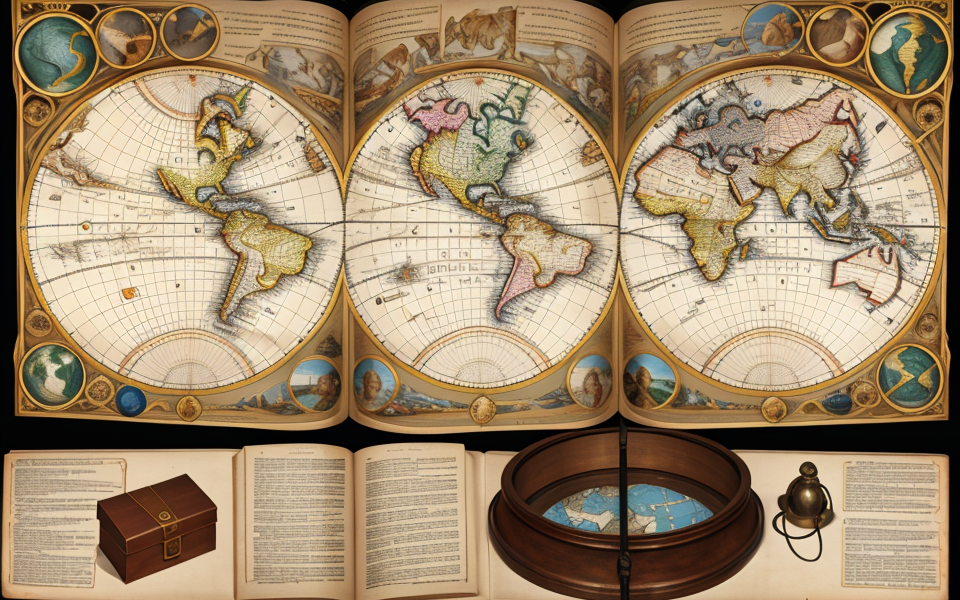
Geography, the study of the Earth’s physical features, human populations, and the ways in which people interact with the environment, has been a cornerstone of human knowledge for centuries. But who was behind the creation of this dynamic field? The answer to this question is shrouded in history and speculation, but we do know that the study of geography has its roots in ancient civilizations and has evolved over time to become the discipline we know today. Join us as we delve into the origins of geography and uncover the story of its inventors.
The Ancient Roots of Geography
The Earliest Geographical Theorists
In the realm of knowledge, geography as a field of study has its roots in antiquity. Its development was influenced by numerous scholars, each contributing to its growth and evolution. The earliest geographical theorists, such as Anaximander, Pythagoras, and Herodotus, played a pivotal role in shaping the discipline as we know it today.
Anaximander, a pre-Socratic Greek philosopher, was one of the first to propose the idea of a curved Earth. He believed that the Earth was a cylindrical shape and that its inhabitants would eventually fall off the edges if they traveled far enough. This idea laid the foundation for future geographical exploration and the understanding of the Earth’s geography.
Pythagoras, a renowned mathematician and philosopher, also made significant contributions to the development of geographical thought. He believed that the Earth was a sphere and that its shape was related to the perfect mathematical ratios he discovered. This idea helped to establish the Earth as a three-dimensional object and set the stage for further advancements in geographical knowledge.
Herodotus, often referred to as the “Father of History,” was an influential figure in the development of geography as a field of study. He traveled extensively throughout the ancient world, documenting his observations and collecting information about different cultures and lands. His work, “The Histories,” provided a comprehensive account of the known world at that time and laid the groundwork for the systematic study of geography.
These early geographical theorists not only contributed to the development of geographical thought but also inspired future generations of scholars to continue exploring and understanding the world around them. Their ideas and discoveries set the stage for the modern discipline of geography, which continues to evolve and shape our understanding of the world today.
The Significance of Geography in Ancient Cultures
In ancient times, geography played a vital role in shaping the cultures and societies of various civilizations. The significance of geography in ancient cultures can be observed in several ways, including:
- Navigation and Trade: Ancient cultures relied heavily on navigation and trade for their economic growth and survival. Knowledge of geography was essential for establishing trade routes, identifying safe passageways, and locating resources such as food, water, and minerals. For example, the Phoenicians, known for their seafaring prowess, used their understanding of geography to establish a vast trading network that spanned across the Mediterranean region.
- Religion and Mythology: Ancient cultures often linked their religious beliefs and mythology to the geographical features of their environment. The ancient Greeks, for instance, believed that their gods resided on Mount Olympus, the highest peak in Greece, and saw the world as a series of interconnected regions ruled by different gods. Similarly, the ancient Egyptians associated their gods with specific geographical features, such as the Nile River, which was considered the life force of their civilization.
- Defense and Warfare: Knowledge of geography was also crucial for ancient cultures in terms of defense and warfare. The layout of the land, including mountains, rivers, and forests, influenced the construction of fortifications and the movement of armies. For example, the Great Wall of China, built to protect the Chinese Empire from invading armies, was strategically constructed along a series of mountain ranges and valleys.
- Settlement and Agriculture: Finally, geography played a significant role in determining where ancient cultures settled and how they practiced agriculture. The availability of fertile land, water sources, and climate conditions were all factors that influenced the choice of settlement locations. The ancient Chinese, for example, developed a sophisticated system of irrigation canals to cultivate rice in the fertile river valleys of the Yangtze River.
Overall, the significance of geography in ancient cultures was pervasive and multifaceted, reflecting the complex interplay between human societies and their environments.
The Renaissance and the Re-Emergence of Geography
The Contributions of Ptolemy and other Geographers
The contributions of Ptolemy and other geographers during the Renaissance period played a crucial role in shaping the field of geography as we know it today. Ptolemy, a Greek astronomer and geographer, lived in the 2nd century AD and is known for his work “Geography,” which was a compilation of all the geographical knowledge of his time.
Ptolemy’s work was influential in several ways. Firstly, he established the use of latitude and longitude as a means of defining a location on the Earth’s surface. He also introduced the concept of a grid system, which allowed for a more accurate representation of maps. Additionally, Ptolemy’s work provided a foundation for the study of cartography, the making of maps, and the use of mathematical principles in geography.
However, Ptolemy’s work was not without its flaws. His maps of the world were based on incomplete or inaccurate data, and some of his ideas about the world’s geography were later proven to be incorrect. Nevertheless, his work laid the groundwork for future geographers to build upon and improve upon.
Other geographers during the Renaissance period also made significant contributions to the field. For example, the Flemish cartographer Abraham Ortelius is known for creating the first modern atlas, which was a collection of maps that covered a wide range of topics, including geography, history, and science. Another important figure was Gerardus Mercator, a Flemish cartographer who is known for developing the Mercator projection, a type of map projection that allows for accurate representation of directions and distances.
In conclusion, the contributions of Ptolemy and other geographers during the Renaissance period played a crucial role in shaping the field of geography. Their work provided a foundation for future geographers to build upon and improve upon, and their ideas and innovations continue to influence the field today.
The Role of Maps in the Renaissance
The Renaissance was a time of great cultural and intellectual awakening in Europe, and the study of geography played a significant role in this revival. During this period, maps became an essential tool for exploration, navigation, and understanding the world. They were used to chart new territories, navigate uncharted waters, and gather information about the earth’s surface.
One of the most influential figures in the field of cartography during the Renaissance was the Italian mapmaker, Fra Mauro. He created one of the most detailed and accurate maps of the world at that time, which was based on the latest available knowledge and information. His work helped to establish a new standard for mapmaking and inspired many other cartographers to follow in his footsteps.
The Renaissance also saw the development of new techniques for creating maps, such as the use of perspective and shading to create a more realistic representation of the world. These techniques were used to create highly detailed and accurate maps that helped to expand knowledge of the world and encourage exploration.
Overall, the role of maps in the Renaissance was crucial in the development of geography as a field. They provided a means of gathering and interpreting information about the world, and inspired a new generation of explorers and mapmakers to continue pushing the boundaries of knowledge and discovery.
The Scientific Revolution and the Evolution of Geography
The Influence of Cartography on the Scientific Revolution
During the Scientific Revolution, cartography played a crucial role in shaping the development of geography as a field. Cartography, the study and practice of making maps, had been around for centuries, but it was during this time that it began to influence the scientific community in a significant way.
One of the key ways in which cartography influenced the Scientific Revolution was through the development of more accurate and detailed maps. These maps allowed scientists to better understand the world around them and to make more informed observations about the natural world. For example, maps of the earth’s surface allowed scientists to better understand the distribution of plants and animals, while maps of the stars allowed them to better understand the universe.
Another way in which cartography influenced the Scientific Revolution was through the development of new technologies and techniques for mapping. For example, the invention of the quadrant and other navigational tools allowed sailors to accurately chart the earth’s surface and to navigate across oceans. This, in turn, led to the development of more accurate maps and the creation of new knowledge about the world.
Overall, the influence of cartography on the Scientific Revolution was significant, and it helped to shape the development of geography as a field. Through the creation of more accurate maps and the development of new technologies and techniques for mapping, cartography allowed scientists to better understand the world around them and to make more informed observations about the natural world.
The Emergence of Modern Geography as a Scientific Discipline
During the late 18th and early 19th centuries, a period of profound intellectual and scientific revolution, modern geography emerged as a distinct academic discipline. The Scientific Revolution, characterized by a shift from Aristotelian to more empirical and experimental approaches, significantly influenced the development of geography. This paradigm shift led to the creation of a new, more rigorous, and systematic field of study, one that sought to explain the complexities of the natural world and human societies.
In this emerging discipline, the application of mathematics, particularly cartography and the use of innovative technologies such as telescopes and quadrants, played a crucial role. These tools enabled geographers to more accurately measure and map the Earth’s surface, gathering data and creating models that could provide insights into global phenomena.
As a result of these advancements, geography became a valuable instrument for exploration, commerce, and imperial expansion. The work of prominent geographers like Alexander von Humboldt, who proposed the concept of isotherms and isopleths to better understand climate patterns, further established geography as a vital field of inquiry. Humboldt’s work on global climate zones and his emphasis on the interconnectedness of Earth’s natural systems significantly influenced later geographers and thinkers, including Charles Darwin.
This period also saw the development of specialized subfields within geography, such as geomorphology, climatology, and biogeography. The growing recognition of the importance of spatial analysis and the use of statistical methods to study geographic phenomena contributed to the development of modern geography as a scientific discipline.
As the study of geography continued to evolve, so too did its methodologies and techniques. The application of quantitative analysis and the development of computer-based geographic information systems (GIS) in the latter half of the 20th century revolutionized the field, enabling geographers to analyze and model complex spatial data on an unprecedented scale.
In conclusion, the emergence of modern geography as a scientific discipline was a gradual process that occurred in the context of the broader Scientific Revolution. This period of profound intellectual and scientific change saw the development of new tools, methods, and subfields within geography, all of which contributed to the establishment of geography as a rigorous and systematic field of study.
The Contributions of Key Figures in the Development of Geography
Alexander von Humboldt and the Expansion of Geography
Alexander von Humboldt was a Prussian polymath who made significant contributions to the field of geography. He was born in 1769 in Berlin, and his early education was focused on the natural sciences. Humboldt’s work laid the foundation for modern geography and his ideas influenced many later geographers.
One of Humboldt’s most important contributions to geography was his concept of the “unity of nature.” He believed that all aspects of the natural world were interconnected and that the study of one part of the natural world could provide insights into other parts. This idea was a departure from the traditional view of geography as a collection of separate disciplines, such as climatology, geology, and biogeography.
Humboldt’s work also emphasized the importance of fieldwork in geography. He believed that direct observation and experience were essential for understanding the natural world. This led him to undertake extensive travels, during which he gathered data and made detailed observations about the natural world. His most famous journey was to South America, where he spent five years exploring and collecting data.
Humboldt’s work also had a significant impact on the development of the field of ecology. He recognized the importance of understanding the interactions between living organisms and their environment, and he developed the concept of the “biosphere” to describe the global community of living organisms.
In addition to his contributions to geography, Humboldt was also a major figure in the fields of botany, zoology, and climate science. His work had a profound influence on the development of these fields, and his ideas continue to be studied and debated today.
Overall, Alexander von Humboldt’s contributions to the field of geography were significant and far-reaching. His ideas about the unity of nature and the importance of fieldwork laid the foundation for modern geography, and his work had a major impact on the development of other scientific fields as well.
Carl Ritter and the Foundations of Modern Regional Geography
Carl Ritter was a German geographer who is widely regarded as one of the founding figures of modern regional geography. He was born in 1779 in Erfurt, Germany, and went on to study at the University of Leipzig, where he received a doctorate in philosophy. Ritter’s interest in geography was sparked by his studies in natural history and the works of the French geographer, Alexander von Humboldt.
One of Ritter’s most significant contributions to the field of geography was his emphasis on the importance of regional analysis. He believed that the study of geography should focus on the unique characteristics of different regions, rather than attempting to create a universal theory of the Earth. Ritter argued that the physical, cultural, and economic features of a region were all interconnected and needed to be considered as a whole in order to understand the region’s dynamics.
Ritter’s ideas about regional geography were revolutionary at the time, and his work helped to establish the field as a distinct academic discipline. He wrote extensively on the subject, publishing several books and articles that are still widely read and studied today. One of his most influential works was “Die Entwickelung der physischen Geographie seit der Zeit von Leonardo da Vinci” (The Development of Physical Geography since the Time of Leonardo da Vinci), which was published in 1822.
In addition to his work on regional geography, Ritter was also an important figure in the development of human geography. He recognized the importance of studying the relationships between humans and their environment, and he believed that geography should be used to understand the social and economic factors that shape human societies.
Overall, Carl Ritter’s contributions to the field of geography were significant and far-reaching. His emphasis on regional analysis and the importance of understanding the interconnections between physical, cultural, and economic features of a region helped to establish geography as a distinct academic discipline, and his work continues to be studied and referenced by geographers today.
The Influence of Culture and Society on the Development of Geography
The Impact of Colonialism on the Evolution of Geography
The evolution of geography as a field was greatly influenced by the impact of colonialism. During the colonial period, European powers established colonies in various parts of the world, leading to the encounter and exchange of ideas, cultures, and knowledge systems between the colonizers and the colonized. This encounter had a profound impact on the development of geography as a field.
One of the significant outcomes of colonialism was the creation of new maps and the expansion of knowledge about different regions of the world. European powers, particularly the Spanish and the Portuguese, were responsible for mapping large parts of the world, including the Americas, Africa, and Asia. These maps were not only used for navigation but also for establishing control over territories and resources. The knowledge gained from these explorations was later incorporated into the field of geography, shaping its development and direction.
Furthermore, colonialism also led to the creation of new geographical theories and ideas. European explorers and scientists developed theories about the Earth’s shape, size, and the nature of its inhabitants. These theories were often based on racist and ethnocentric beliefs, which had a profound impact on the way geography was taught and studied. For example, the concept of “the noble savage” was used to justify colonialism and imperialism, and it was often portrayed in geographical texts and maps.
Additionally, colonialism also had an impact on the way geography was taught and studied in universities. Many universities in Europe and North America were founded during the colonial period, and they were heavily influenced by the colonial agenda. The curriculum in these universities often focused on the geography of the colonies, with little attention given to the geography of the colonized countries. This focus on the geography of the colonies shaped the direction of geographical research and teaching for many years to come.
In conclusion, the impact of colonialism on the evolution of geography was significant. It led to the creation of new maps, theories, and ideas about the world, and it shaped the direction of geographical research and teaching in universities. While some of these ideas and theories have been challenged and replaced over time, the legacy of colonialism continues to influence the field of geography today.
The Role of Geography in Nationalism and the Formation of Nations
The role of geography in nationalism and the formation of nations cannot be overstated. As the world began to become more interconnected, nations started to emerge as distinct entities with their own cultures, languages, and identities. Nationalism, which is the ideology that seeks to promote the interests of a particular nation, played a crucial role in this process. Geography, with its emphasis on the study of the relationship between human societies and the environment, was a natural fit for this new ideology.
One of the ways in which geography influenced nationalism was through the creation of national maps. Maps allowed people to visualize the borders of their nation and to understand the physical features that defined it. They also helped to create a sense of national identity by highlighting the unique characteristics of a particular region. For example, maps of France might emphasize the country’s extensive river system, while maps of Germany might focus on the rugged terrain of the Alps.
In addition to creating national maps, geographers also played a role in defining the borders of nations. This was particularly important in the late 19th and early 20th centuries, as Europe was carved up into nation-states. Geographers used a variety of methods to determine the most appropriate borders, including analyzing language and cultural affiliations, as well as studying the physical environment.
The role of geography in nationalism did not stop at the creation of maps and the definition of borders. Geographers also played a role in promoting the idea of national identity. They did this by studying the unique characteristics of different regions and highlighting the ways in which they contributed to the overall identity of a nation. For example, they might study the food, music, and language of a particular region and show how these elements contributed to the distinct character of the nation as a whole.
In conclusion, the role of geography in nationalism and the formation of nations was significant. By creating national maps, defining borders, and promoting national identity, geographers helped to shape the modern world as we know it today. As we continue to navigate the complex relationships between human societies and the environment, it is important to remember the important role that geography has played in shaping our world.
The Future of Geography: Advancements and Challenges
Technological Advancements and Their Impact on Geography
Geographic Information Systems (GIS)
- The emergence of GIS in the late 1960s
- The development of GIS software, such as ArcGIS and QGIS
- GIS applications in various fields, including urban planning, natural resource management, and environmental studies
- The integration of GIS with other technologies, such as remote sensing and spatial analysis
Geographic Web Services (GWS)
- The growth of web-based GIS services, such as Google Maps and OpenStreetMap
- The development of GWS standards, such as the GeoJSON format
- GWS applications in real-time data visualization, location-based services, and collaborative mapping
- The challenges of ensuring data quality and accuracy in web-based GIS
Mapping Mobile Applications
- The proliferation of mobile devices and location-based services
- The development of mapping applications for iOS and Android devices
- The integration of mapping with other mobile features, such as navigation and social media
- The challenges of data privacy and security in mobile mapping applications
Unmanned Aerial Vehicles (UAVs) and Remote Sensing
- The increasing use of UAVs for aerial photography and remote sensing
- The development of UAV-mounted sensors, such as multispectral and hyperspectral imagers
- The applications of UAV remote sensing in land use/land cover mapping, crop monitoring, and disaster response
- The challenges of regulating UAV use and ensuring data quality in remote sensing
These technological advancements have transformed the field of geography, providing new tools and techniques for data collection, analysis, and visualization. However, they also pose challenges, such as ensuring data quality and privacy, and raising ethical concerns related to the use of these technologies.
Environmental Challenges and the Role of Geography in Addressing Them
Environmental challenges, such as climate change, natural disasters, and resource depletion, pose significant threats to the well-being of societies and ecosystems worldwide. These challenges are complex and interconnected, and their causes and consequences are often geographically uneven. Therefore, the study of geography is critical in understanding and addressing these environmental challenges.
One of the primary roles of geography in addressing environmental challenges is to provide a spatial perspective. By analyzing the distribution and patterns of environmental phenomena, geographers can identify the areas most vulnerable to natural disasters, such as hurricanes, floods, and droughts. They can also study the impacts of climate change on ecosystems, agriculture, and human populations. Furthermore, geographers can use spatial analysis to understand the complex relationships between environmental factors, such as land use, water resources, and energy consumption, and human activities, such as urbanization, industrialization, and transportation.
Another critical role of geography in addressing environmental challenges is to develop and implement sustainable solutions. Geographers can use their knowledge of the spatial patterns and processes of environmental phenomena to design and evaluate policies and projects that promote sustainable development. For example, they can analyze the impacts of land use changes on biodiversity and ecosystem services, and develop strategies to preserve and restore natural habitats. They can also study the social and economic factors that influence the adoption of sustainable practices, such as renewable energy and sustainable agriculture, and design interventions that promote behavior change.
In addition, geography can play a critical role in promoting environmental justice. Environmental challenges often affect marginalized communities disproportionately, and geographers can use their spatial perspective to identify and address these inequalities. For example, they can study the distribution of environmental hazards, such as air pollution and toxic waste, and advocate for policies that protect the health and well-being of vulnerable populations. They can also study the impacts of climate change on marginalized communities, such as indigenous peoples and coastal communities, and develop strategies to promote their resilience and adaptive capacity.
Overall, the role of geography in addressing environmental challenges is multifaceted and critical. By providing a spatial perspective, developing sustainable solutions, and promoting environmental justice, geographers can contribute to a more sustainable and equitable future for all.
The Impact of Early Geographers on the Modern Field
Early geographers played a pivotal role in shaping the modern field of geography. Their groundbreaking work and contributions have laid the foundation for the discipline as we know it today. Here are some of the ways in which their impact can be seen in the modern field of geography:
- Cartography and mapping techniques: Early geographers such as Ptolemy and Eratosthenes were pioneers in map-making and cartography. Their techniques and methods for creating maps and globes have been refined and improved upon over time, but their contributions remain foundational to the field.
- Environmental conservation and sustainability: The work of early geographers such as Alexander von Humboldt helped to lay the groundwork for the modern environmental movement. Humboldt’s emphasis on the interconnectedness of natural systems and his advocacy for environmental conservation have influenced modern geographers’ focus on sustainability and the impact of human activity on the environment.
* **Human geography and cultural studies:** Early geographers such as Paul Vidal de la Blache and David Harvey were instrumental in developing the subfield of human geography, which focuses on the social and cultural aspects of geography. Their work has influenced modern geographers’ interest in issues such as urbanization, globalization, and cultural identity. - Technological advancements: Early geographers such as William Morris Davis were pioneers in the use of technology in geography. Davis’s work on the development of weather maps and other technological innovations has been built upon by modern geographers, who use cutting-edge technology such as GIS and remote sensing to study the Earth’s surface.
Overall, the impact of early geographers on the modern field cannot be overstated. Their work has shaped the discipline in countless ways, from the methods and techniques used by geographers today to the topics and issues that geographers study. By understanding the contributions of these pioneers, we can better appreciate the rich history and ongoing evolution of geography as a field.
The Continued Relevance of Geography in the 21st Century
The continued relevance of geography in the 21st century cannot be overstated. Despite the rapid advancements in technology and the increasing reliance on digital mapping tools, traditional geography remains an essential discipline. This is particularly true in the context of contemporary global challenges, such as climate change, urbanization, and political instability. In this section, we will explore the ways in which geography remains relevant in the 21st century and the various factors that contribute to its continued importance.
- Understanding the Impact of Climate Change
Climate change is one of the most pressing global challenges of our time, and geography plays a crucial role in understanding its impact. By analyzing the effects of climate change on different regions, geographers can help inform policy decisions and develop strategies for adaptation and mitigation. This is particularly important in developing countries, where the impacts of climate change are often most severe.
- Urbanization and the Future of Cities
Another major challenge facing the world today is urbanization. As more people move to cities, the need for effective urban planning and management becomes increasingly important. Geographers are well-positioned to address these challenges, as they have a deep understanding of the spatial patterns and processes that shape urban areas. By analyzing the social, economic, and environmental factors that influence urban development, geographers can help policymakers and urban planners make informed decisions about the future of our cities.
- Political Instability and Geopolitical Tensions
Finally, geography remains relevant in the context of political instability and geopolitical tensions. By analyzing the complex geographical, social, and economic factors that contribute to these challenges, geographers can help policymakers develop effective strategies for managing conflicts and promoting stability. This is particularly important in regions where political instability threatens global security and economic stability.
Overall, the continued relevance of geography in the 21st century is a testament to the enduring value of this dynamic field. Whether addressing the challenges of climate change, urbanization, or political instability, geographers have a crucial role to play in shaping our understanding of the world and informing the decisions that will shape our future.
FAQs
1. Who invented geography and why?
Geography as a field of study has a long and complex history, and it is difficult to attribute its invention to a single person. However, many scholars believe that the ancient Greeks were among the first to develop the principles of geography. Eratosthenes, a Greek mathematician and astronomer, is often credited with being one of the earliest geographers. He developed a system for measuring the Earth’s circumference and created the first known world map.
2. When was geography first recognized as a separate field of study?
The modern academic discipline of geography emerged in the 19th century, although the study of geography and the mapping of the Earth’s surface has a much longer history. The Greek philosopher Plato wrote about the importance of geography in the development of a civilization, and the ancient Chinese and Egyptian cultures also had rich traditions of cartography and spatial analysis. However, it was not until the 19th century that geography became recognized as a distinct academic field, with the establishment of specialized departments and journals dedicated to the study of the Earth’s surface and human activity upon it.
3. Why is geography important?
Geography is important because it helps us understand the relationships between human societies and the natural environment. It helps us to understand how the Earth’s physical features, such as rivers, mountains, and climate, affect human activity, and how human activity, in turn, shapes the Earth’s surface. Geography is also important for understanding global issues such as climate change, economic development, and political conflict. By studying geography, we can gain a deeper understanding of the complex interconnections between human societies and the natural world, and develop more effective strategies for addressing some of the most pressing challenges facing our planet today.